Angle’s Landing, Navajo Lake

Angle's Landing Trail

Angle’s Landing Trail

We’re settling into a routine. We work Sat – Tue, then we get 3 days off. That makes Friday the end of our weekend. We usually spend one day chore-ing, which includes a grocery run to Kanab (about 25 miles), along with a stop at the library and other miscellaneous stuff. The other 2 weekend days are spent visiting sights in the area.


Angle's Landing - End

Angle’s Landing – End

This week I went back to Zion without Danita and hiked Angle’s Landing. This is the most popular trail in the park. It’s 5 miles long with 1500 feet of vertical gain. There’s no way Danita would attempt this with her knee, plus her aversion to heights. The trail is listed  as strenuous, is famously narrow, and has a chain to help hikers. I found it to be a fun hike of mostly walking up an incline path, followed by simple rock scrambling. There was one spot I really wanted the chain. For the rest of the hike, the chain wasn’t needed and sometimes was just in the way.

View from Angle's Landing

View from Angle’s Landing

You know you’re at the end of the trail when you see everybody ahead of you either sitting down or taking pictures. There were obviously amazing views of deep canyons and big rocks, but they tend not to photograph very well. There were a couple of chipmunks who were afraid of nothing. I had to warn one woman about the chipmunk going inside her pack. Following my new hobby of eating lunch in amazingly beautiful places, I found the chipmunks especially interested in my cashews.

Cascading Falls Trail

Cascading Falls Trail

With only one more day for visiting, Danita and I decided to visit Navajo Lake. We found very little information about the area. Since it’s at 9,000 feet, the visitor’s center and all but a few camp sites were closed for the season. We decided to hike a trail called Cascading Falls – one mile round trip with mild elevation changes. It turned out to be the surprise of our trip so far. The trail was near the ridge of the cliff with spectacular views all the way to Zion park. It took us quite a while to hike this trail because I kept on stopping to take pictures.

Cedar Mirror Lake's stream

Cedar Mirror Lake’s stream

When we got back to the car, we took another trail to Aspen Mirror Lake. This turned out to be a delightful pond with a very nice mountain stream. The overall hike was less than a mile, but the area was quite lovely. We even found a substantial beaver dam downstream a little. We continued our new hobby (eating lunch in amazingly beautiful places) by eating lunch on one of these lava rocks.

I hope this finds everybody doing well.


Pipe Spring, Coral Pink Sands Park, and Zion Park

Pipe Spring Group Photo

Pipe Spring Group Photo

The first pic this week is a group shot of the folks at Pipe Spring. Danita and I are kneeling front & center. The man behind Danita is Asa, our roommate. Asa is a very nice guy and a neat freak besides. We couldn’t get a better roommate. The person kneeling at the extreme left is our supervisor, Kate. Next to her is our alternate supervisor, Eric. The most interesting person at Pipe Spring has an unusual beard and is standing in the back row, third from the right. Benn is a Kaibab Paiute Indian. He lives on the reservation and works as one of the interpreters at the park.

Coral Pink Sand Dunes

Coral Pink Sand Dunes

The most unusual part of our training was the rattlesnake handling session. A woman from the University of Utah came with non-verminous snakes and rattle snakes. She had us handle the non-verminous snake, then pick the snake up with snake tongs, then pick up the rattle snake with snake tongs. Danita and I declined to handle the rattle snake. As a result, we are not qualified to move a rattle snake should one appear on the grounds. So sad!

The sand comes from here

The sand comes from here

We visited Coral Pink Sand Dune park Wednesday. The view above is what we saw when we walked over the top of the first sand dune. The Vermilion Cliffs are in the background. The second view shows where the sand comes from. The wind erodes sandstone. It funnels between Moquith and Moccasin Mountains, picking up speed and carrying the sand. On our side of the pass, the wind fans out, slows down, and deposits the sand. Sand is also blocked by the Vermilion Cliffs. The result is a beautiful sand dune playground. Younger folks ride sand boards (like snow boards, but on the sand). Richer folks ride OHVs (Off-Highway Vehicles) around the park.

Cactus Flower at Zion Park

Cactus Flower at Zion Park

Here’s how you make a sand dune playground of your own. Gather enough white sand to cover parts of six states. Cover with ocean, add iron oxide and let sit 170 million years. Sand will turn a nice rosy sandstone. Elevate the area to 5,000 feet (the Colorado Plateau). Expose sandstone to elements and let erode into coral-colored grains.


Zion Park Court of the Patriarchs: Abraham, Isaac, and Jacob

Zion Park Court of the Patriarchs: Abraham, Isaac, and Jacob

Cactus Flower

Cactus Flower

Today we visited Zion Park. IT’s a hour and a half drive if you don’t take the shortcut. If you take the shortcut but don’t have a high clearance 4-wheel drive, it takes the better part of a day plus about $500 to get yourself towed out. The long drive goes through Hurricane, Utah. We got away from the East Coast, but we can’t avoid Hurricane. Zion park has a bunch of very impressive rocks that mostly make for very boring pictures. Most of the pictures are of other things we saw while walking around.

Riverside Walk, going towards Narrow Gorge

Riverside Walk, going towards Narrow Gorge

Danita has been trying to get the results of the MRI of her knee, without us having to drive to St. George. The latest is that she filled out a permission form along with a copy of her driver’s license. There is a possibility we will have the results in a couple of weeks.


Hanging Gardens (Eat your heart out, Babylon)

Hanging Gardens (Eat your heart out, Babylon)

6-point buxk

6-point buxk

Ground squirel

Ground squirel

Arizona News

All the pics this week are from the Grand Canyon.

Walhalla Lookout

Walhalla Lookout

Looking down on the hawks

Looking down on the hawks

I wrote earlier about Danita having a severe problem with her knee. The problem seems to have gone away. Maybe it was the steroid shot. Maybe it just went away. We have no idea what the caused her pain. Results from the MRI are still not available. When Danita checked the hospital’s website, she found our that the person the hospital staff were calling “doctor” is actually a Physician’s Assistant. We are thankful that she isn’t having problems. We are not taking significant hikes. Danita hasn’t ridden her bike.

The trail at Angle's Point got quite narrow, dropping off on both sides

The trail at Angle’s Point got quite narrow, dropping off on both sides

Yesterday we went back to visit — and see — the grand canyon. We took a 0.8 mile walk to Angle’s point behind the lodge. I scrambled up on a rock for the picture above. Then we drove out to see Angel’s Window and Cape Royal, stopping at the view points along the way. The views were spectacular. I finally stopped adding pictures to this blog because there would be too many, and because no picture can describe the feeling of being here.

We were delighted that we decided to re-visit the canyon.

Today it’s back to work. This is our last week of training.

At Walhalla Lookout

At Walhalla Lookout

Encantada Overlook

Encantada Overlook

Encantada Overlook

Encantada Overlook

Roosevelt Overlook

Roosevelt Overlook

I couldn’t resist taking this picture. The couple had obviously been married for a long time. The woman was telling her husband that he was too close to the edge. The man was totally intent on getting the perfect picture.

At Angle's Window

At Angle’s Window

Angle's Window

Angle’s Window

End of the Epic Journey

The Epic Journey ended with a visit to the North Rim of the Grand Canyon. This visit is a perfect example of our definition of an adventure – Things don’t always go well. It’s all part of the adventure.

Halfway View

Halfway View

The trip to the North Rim Tuesday morning was mysterious and wonderful. It was mysterious because we were never quite sure we were on the right road. There were plenty of indications we were doing the right thing, but we expected to see a lot more signage than we saw. And we experienced a lot less traffic than we expected when approaching such a well-known site. As it happened, we were on the right road all along. The wonderful part was a continuation of the amazing landscapes. The picture shows a panoramic view about an hour from Pipe Spring, and half way to the North Rim. After we decided to stop, we also saw there were toilets, which made the rest of the ride much more comfortable.

Our view of the North Rim

Our view of the North Rim

By the time we arrived at the North Rim, rain had set in. I heard the rain was caused by hurricane Paine. We spent some time at the ranger station psyching out trails and viewpoints. By the time we were through with that, fog had set in. The entire day was spent inside the lodge common areas looking for a place to sit and for something to do while we waited out the weather. The lodge had every room reserved. Many of us were waiting until the rooms were available for us to check in. The ranger presentations had record-high attendance. The geologist, who has been doing this for 4 years, said this was the first time he was obliged to do his presentation indoors.
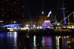
Clearest view all day

Clearest view all day

Danita had been experiencing some difficulty with one leg. She had pain starting in her hip that occasionally went all the way down to her foot. She was taking it easy and taking Aleve. For no apparent reason, after the geology presentation, she experienced extreme pain in her knee, to the point that she had difficulty walking even with a walking stick on one side and me on the other. We ended up requesting a golf cart to take us the short walk from our cabin to the common areas so we could have dinner.

 When we woke up Wednesday morning, the weather was much better. It was still cloudy, but there was no rain and the fog was gone. However, Danita was still having so much difficulty that she couldn’t walk from our cabin to get a quick glance of the Grand Canyon. We confirmed our intention to leave very early in the morning so we could get to the hospital in Kanab before 9 and get some medical help. (Kanab is 2 hours from the North Rim and half an hour from Pipe Spring. It has the closest hospital to Pipe Spring.) Their doctor examined Danita and they took some X-rays. Then they gave Danita a steroid shot. That’s all they could do in Kanab. They ordered an MRI in St. George, which we will get done Friday. In the meantime, Danita’s taking it easy but back on her feet.

 I visited the more popular South Rim of the Grand Canyon on my first Epic Journey. Danita and I took the kids on a Western tour and visited the South Rim again. Both times we enjoyed excellent health, excellent weather, and amazing views. Based on my limited experience, I definitely recommend visiting the South Rim.


EJ – Cedar Breaks

dsc02223


dsc02227We went to a very nice service at the church here in town. Then we went up the mountain to Cedar Breaks National Monument today. It’s about 10,000 feet in elevation. It is reputed to be one of the best 5 places to see the fall colors. The colors were out today for sure. We drove the first half of the park road and took a moderate 2-mile hike. We finished the hike about 1:30 and drove back to the picnic area. It was breathtakingly beautiful scenery and a wonderful hike.

This alpine pond reflects the surrounding vegetation in perfectly still water

This alpine pond reflects the surrounding vegetation in perfectly still water

That was enough for us today. We’re enjoying a down day for the rest of the day. We don’t even have to leave the hotel for dinner. We’re having leftovers from yesterday’s restaurant visit.


dsc02247Tomorrow we will drive to Pipe Spring. We’re just setting up our room and crashing for the night. After that, we’ll have two days at the North Rim of the Grand Canyon before returning to Pipe Spring and starting our training.

The breeze was blowing the leaves, making them sparkle in the sunlight

The breeze was blowing the leaves, making them sparkle in the sunlight

dsc02255

dsc02276

EJ – Cove Fort

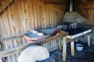
Way Cool Stove

Way Cool Stove

I-70 starts in the Social Security Park-and-Ride in Baltimore and ends at I-15 in UT, just one mile beyond Cove Fort. We made it to Cove Fort yesterday. It’s not a bucket list item, but it is a milestone of our trip. The Cove Fort museum is run by the LDS (Latter Day Saints), as the Mormons call themselves. The most important part of the tour was the kitchen, where we saw the coolest stove we have ever seen from the era. With its dual ovens and ability to use coal, it was state of the art. The stove was certainly welcome, as Cove Fort was an important stop for Church leaders as they conducted their business, and an important stop for Mormons migrating west, and also the tithing farm. They prepared 70 to 90 dinners a day. Cove Fort was located to bridge a gap between two other Mormon cities. (Cities were 30 miles apart because that was a good day’s travel, and because that was the limit of the length of a single telegraph line.) The LDS built the Fort because there wasn’t enough water to support a town.

Recycling

Recycling – Ticking cloth, pants, and stripes are shown here

There is no charge to visit Cove Fort. If you arrive, a friendly guide will make themselves available to you immediately, no matter the size of your party. But of course nothing is free. Your guide will be an LDS missionary. Ours was very good at being low key. Here’s a story of life in the late 1800s that was probably true of most people in the West. Ticking is used to make mattresses. When the mattress wears out, better parts of the cloth are used to make pants. When the pants wear out, better parts of the cloth are cut into stripes and stored in balls. The stripes are later used to make rag rugs. When the rugs wear out, what’s left is used to help make soap. Soap is the end of the line for the recycling of the ticking.

Linsey Woolsey Blanket

Linsey Woolsey Blanket

If you lived out west, you wanted a warm blanket. Wool is warm, but it’s scratchy and it can be hard to sleep under. That made linsey woolsey blankets popular. The wool made the blanket war,. The linen made it less scratchy.

I also learned that the telegraph used water batteries (which used copper sulfate,  copper, zinc, and water). Because the telegraph was limited to 30 miles, a telegraph operator had to receive and re-transmit messages to the next station. Cove Fort had one operator, who was on duty 24×7.


1930s Mining Shovel

1930s Mining Shovel

After we finished at Cove Fort, it was a short drive to Cedar City. Our room wasn’t ready when we arrived an hour before check-in time, so we visited a local history museum. Mining was an important industry in the early days of Cedar City. Here is a 1930-era mining shovel. It was powered by a 23,000 volt electric tether and had a 275 hp motor-generator. Moving it to a new site involved using two bulldozers. Amazingly, this shovel was used continuously until 1975. For all its size, the dipper capacity was 6 cubic yards. That’s the size of a large extended cab pickup truck, but it struck me as somewhat small considering the overall size of the machine.

Mining Shovel Bucket

Mining Shovel Bucket

We came back to the hotel an hour after check-in time to find our room still wasn’t ready. We waited another hour beyond that. That’s bad enough, but the hotel had also rented the breakfast area out to some kind of family party. Very excited, very loud kids were running all over the place. We were pretty tired by the time we got to our room. Danita had found a nice restaurant for us, but the information was lost. We took the desk clerk’s recommendation, but the street had two names. We were given one name, the GPS used the other. Once we figured that out, we drove by it before finding it. We were too tired to enjoy dinner. We feel much better after a night’s sleep.

Cedar City has the “Western Look”. Here is a list of some movies made in Cedar City.

Deadwood Coach, staring the popular cowboy Tom Mix – the first movie
The Good Earth
Union Pacific (Cecil B. DeMille, 1939)
Drums Along the Mohawk
Brighham Young
Can’t Help Singing
My Friend Flika
Proud Rebel


EJ – Canyonlands Park

dsc02150

dsc02137If you ever visit this part of Utah, I highly recommend you visit Canyonlands National Park. We visited the “Island in the Sky” area, which is the area most accessible to Moab. We only saw one arch. But we saw a lot of amazing scenery. We had more fun in Canyonlands than I had at Arches. Canyonlands is less popular and has a lower capacity for visitors. It was less overwhelming, and every bit as interesting as Arches.

Desert Zen garden, designed by The Master Gardner

Desert Zen garden, designed by The Master Gardner

We thought we would spend less time in Canyonlands. We ended up spending almost as much time as we did in Arches.

We have extra time to relax today. We are staying two nights in a row in Moab. They aren’t both in the same hotel. When we decided to extend our stay in Moab I went on the Interhet to get a second room. I had the reservation. But I came up with an error — somebody else had taken the room while I was entering the credit card number. We’re getting pretty good at packing and unpacking. And it’s nice to have a couple of extra hours down time plus much less driving than usual.

dsc02121How would you like to eat lunch here? With the amazing garden. The promise of many interesting things inside. The original, humorous, and friendly super-sized cup of coffee steaming so invitingly? We couldn’t resist eating lunch there today. We both had Ruben sandwiches. The staff were very efficient and very friendly. The food was very good. The prices were reasonable — especially considering Moab is a tourist trap town.
dsc02173Here are a few more pics I can’t resist posting, all from Canyonlands.

dsc02146

dsc02165

dsc02183

dsc02129

EJ – Arches National Park

dsc02045

dsc02093After a 2.5 hour drive, we spent the rest of our day at Arches National Park. The day started out fantastic. There was a 1/3 mile line to get into the park. After we were in the line for a while, two rangers came out and moved some road cones. They then asked if I already have a pass. (I do — the National Parks Senior Pass.) They let me bypass the line and drive into the park. I was the first person today to receive this offer. I felt so special!

dsc02052The park is all about the sandstone which has eroded and turned into walls, or columns, or arches. But I also found the plant growth quite interesting. I was surprised by the variety, quantity, and color variation of what we saw growing in this desert. It goes all the way from traditional cactus to all kinds of flowering and non-flowering plants and even includes deciduous Cottonwood tress and Juniper pine trees..

Danita discusses "husbands" with another guest in front of the double arch

Danita discusses “husbands” with another guest in front of the double arch

We were fortunate the weather was so good. The high temperature was in the mid-70s. That still feels quite warm because of the intense sun. I can’t imagine what its like in the summer time.


Landscape Arch

Landscape Arch

There’s also a large geological variety here — from the sunken salt mounds to major geological faults. The star of the show is still the arches. Here is a picture of the Landscape Arch, which is without a doubt the coolest arch we saw today. There is so much to see. Photos aren’t at all like being here. I usually throw most of my pics away. This time I kept 50 of them. Don’t worry, I won’t put them all in the post.

dsc02046At the end of the day, we drove to Moab, just 5 miles from the park. It’s a pleasant town with a way cool name and a delightful main street. We went to the Moab Diner. We had a nice dinner and a single ice cream that was as large as most triples. All together, it was an exciting and satisfying day.

dsc02105

Underground salt mounds dissolved, causing this huge area of land to sink.


EJ – Hanging Lake

Mountain Stream

Mountain Stream

There is a very popular hike near Glenwood Springs called Hanging Lake. It’s 1.2 miles long, and climbs 1020 feet. It was definitely a stretch goal for Danita, but she wanted to try it. The trail goes up the side of a canyon, following a mountain stream in a wooded area. There are plenty of places where one can see water falls. There are also plenty of places where one can see the shear rock walls of the canyon.


Hanging Lake

Hanging Lake

The weather was perfect — mostly sunny. Temperatures were a little cool, ideal for climbing. Our pace was slow, but we were making steady progress. It took us about 3 hours to climb. A person in good shape should be able to do the round trip in 3 hours. Upon reaching the top, one is rewarded with a beautiful lake. The water is green and clear. Two high waterfalls fill the lake. There is a small cave behind one of the water falls.

Hanging Lake

Hanging Lake

After enjoying the lake, I wanted to walk an additional short but steep trail to Spouting Rock. I asked Danita if she wanted to rest at the lake. She decided to join me. It was a large amount of water coming out of a single hole in the canyon wall. Behind the water spout was a way cool large cave. We had a good time walking around and checking out the area.

Spouting Rock

Spouting Rock

Coming back down was less pleasant for Danita. She had a hard time keeping her balance coming down the steep trail with its uneven rocks. Small showers were coming through. We aren’t familiar with the weather patterns in this area. It didn’t seem that any heavy rain was immanent, but we didn’t want to delay our return to the car. The entire trip took us 5 hours. A picnic lunch and some Aleve helped Danita a little. It was a 90-minute drive to our hotel. Fortunately, the hotel’s pool is indoors and in service. Some time in the pool did wonders for Danita. I don’t think we will attempt any challenging hikes tomorrow.

EJ – Genwood Springs

Mountain

Mountain

We had another exceptional day. We made it to our destination of Glenwood Springs without incident. Our day was divided into three parts. In part 1, we were driving around and saw an incredible area. Part of it was the morning sun. Part of it was exceptionally low temperatures last night (45) that “snapped” the fall colors on like a switch.

Georgetown Loop

Georgetown Loop

The second part was a ride on an old mining train, called the “Georgetown Loop”. It was a lot of fun, with guys taking pictures and wives relaxing. The man you see in front of me in this picture is visiting from Norway. He and his wife shipped their RV to the US. They will be here for at least 6 months. They visited the US twice before, for 3 weeks each. This time, they plan to see “everything else”. The steam locomotive was an unusual gear-drive. These were used in mountainous areas. You can see the drive clearly in this video 08a-locomotive-motion-detail.

14-hike

Hike

Our third activity was a hike at Old Dillon Reservoir. When we got there, it was obviously going to rain soon. We waited in the car. Within 20 minutes, the rain came and went, and the sky was clear again. It was a beautiful trail with a beautiful destination. It’s hard to say for sure what the best part of the day was, but the pie for desert after dinner would certainly be a contender. Here are a few more pics from our day.

Mountain

Mountain

Train

Train

Hike

Hike

Hike

Hike

Hike

Hike